Bligh saved Queensland from the effects of the GFC
AND
Led us through the worst natural disasters in Queensland.
Hear it here*!
*If you can stomach it.
Showing posts with label floods. Show all posts
Showing posts with label floods. Show all posts
Wednesday, March 7, 2012

Monday, January 24, 2011
Means testing for flood aid from the Queensland Premier's Appeal Fund
The Queensland Premier's Flood Appeal fund recipients will be means tested to determine whether they are worthy of receiving funds from this pool which has largely been donated by generous people and businesses Australia wide and, indeed, from around the world. Of course the Premier of Queensland says means testing is fair.
Read more on the means testing here.
Like my mother I believe that everyone should get the same amount of funds, I think that it is fair that the damage to property be determined and the amount of funding be determined by the level of inundation/damage/material loss suffered by each flood victim/family/home. For example, if the whole house has gone under the amount should be X, if the water only covered the floor the amount should by less than X. I'm not sure how to determine how much each case should get, but there should be guidelines which are applied to everyone equally.
Just because a family may earn more than another doesn't mean that they are in a better position to afford to replace/repair/rebuild. I also think that people who are insured should not be punished by not receiving funds from the pool, and those intentionally uninsured should not be rewarded for their lack of preparation.
For example, a $5000 grant to help uninsured home owners to restore essential utilities will not be available to couples with a combined annual income of more than $48,400 or for singles who earn more than $36,600.The line must be drawn somewhere, but why reward the uninsured and not help those who are insured? The donations were to help all people affected by the floods. I don't think that those who are uninsured are more deserving than those who are insured.
Ms Bligh said the payments were modelled on state-federal arrangements and were to ensure the "neediest get the most".
Read more on the means testing here.
Like my mother I believe that everyone should get the same amount of funds, I think that it is fair that the damage to property be determined and the amount of funding be determined by the level of inundation/damage/material loss suffered by each flood victim/family/home. For example, if the whole house has gone under the amount should be X, if the water only covered the floor the amount should by less than X. I'm not sure how to determine how much each case should get, but there should be guidelines which are applied to everyone equally.
Just because a family may earn more than another doesn't mean that they are in a better position to afford to replace/repair/rebuild. I also think that people who are insured should not be punished by not receiving funds from the pool, and those intentionally uninsured should not be rewarded for their lack of preparation.
Saturday, January 22, 2011
Laidley Flood - not as high as 1974 - video
Here you go, found some video of the flood 11/1/11. At the end is stunning video of Murphy's Creek flood on 10/1/11, with before and after pictures of the quiet little creek.
There is a street before the "Hire" and "Solicitor" signs and it was a raging torrent, coming down William Street and crossing Patrick street.
Looking up Spicer Street toward the overpass, opposite Buhse's and the old Laidley Shire Council chambers.
Another short video showing how fast the water was flowing from the IGA carpark through the laneways into Patrick Stret and how swiftly the water was flowing down William Street.
The water flowing down William Street. The pub on the left, green roof, I understand has been condemned as the foundations have been washed away. The yellow building is Jo Jo's salon.
This is looking past Jo Jo's.
Laidley - Rosewood Road, looking west from the east side of Narda Lagoon, near the Pioneer Village. That water is incredible. It washed away some of the roadside and took out the rail along the bridge. In my story on December 27 about being stranded in Laidley the nighttime photos taken on my phone were of this bridge but from the other side. The water is much higher and flowing much faster this time.
Murphy's Creek, from the same storm cell which flooded Toowoomba, but not the same water, and which also flooded Flagstone Creek, Withcott, Helidon and Grantham, destroying houses and taking lives along the way. This video is frightening in that anyone caught in the water would surely be swept away.
There is a street before the "Hire" and "Solicitor" signs and it was a raging torrent, coming down William Street and crossing Patrick street.
Looking up Spicer Street toward the overpass, opposite Buhse's and the old Laidley Shire Council chambers.
Another short video showing how fast the water was flowing from the IGA carpark through the laneways into Patrick Stret and how swiftly the water was flowing down William Street.
The water flowing down William Street. The pub on the left, green roof, I understand has been condemned as the foundations have been washed away. The yellow building is Jo Jo's salon.
This is looking past Jo Jo's.
Laidley - Rosewood Road, looking west from the east side of Narda Lagoon, near the Pioneer Village. That water is incredible. It washed away some of the roadside and took out the rail along the bridge. In my story on December 27 about being stranded in Laidley the nighttime photos taken on my phone were of this bridge but from the other side. The water is much higher and flowing much faster this time.
Murphy's Creek, from the same storm cell which flooded Toowoomba, but not the same water, and which also flooded Flagstone Creek, Withcott, Helidon and Grantham, destroying houses and taking lives along the way. This video is frightening in that anyone caught in the water would surely be swept away.
Wednesday, January 19, 2011
Laidley Flood - where the water came to, compare images
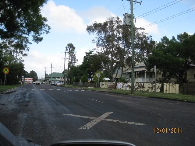
This is a photo I took of the aftermath of the flood in Laidley on 11/1/11. I stood at the pedestrian crossing which is near the top of the town. I will try to get a better comparative photo when the town is empty - that'll be hard, because there's just about always people in town in daylight!

My local journo friend took this photo of Laidley at the height of the flood. He was standing on the railway crossing at the top of the town.There are signs indicating the pedestrian crossing and bollards on each side of the pedestrian crossing which you can see in the second photo. Click to enlarge.

My local journo friend took this photo of Laidley at the height of the flood. He was standing on the railway crossing at the top of the town.There are signs indicating the pedestrian crossing and bollards on each side of the pedestrian crossing which you can see in the second photo. Click to enlarge.

Monday, January 17, 2011
Noah's Ark at Lockyer Valley
UQ Vet Hospital has done a sterling job of looking after strays after the terrible floods in the Lockyer Valley.
Read more here, be sure to click the links at the end of the UQ News article.
Read more here, be sure to click the links at the end of the UQ News article.
Saturday, January 15, 2011
Friday, January 14, 2011
Toowoomba, looking over the Lockyer Valley
This image is taken from the area called Picnic Point, it is at the top of the range, to the east of Toowoomba.
I have an image, but someone is in the photo and I can't use it.

I have an image, but someone is in the photo and I can't use it.
Thursday, January 13, 2011
More info on the flood in Laidley on Tuesday 11JAN11
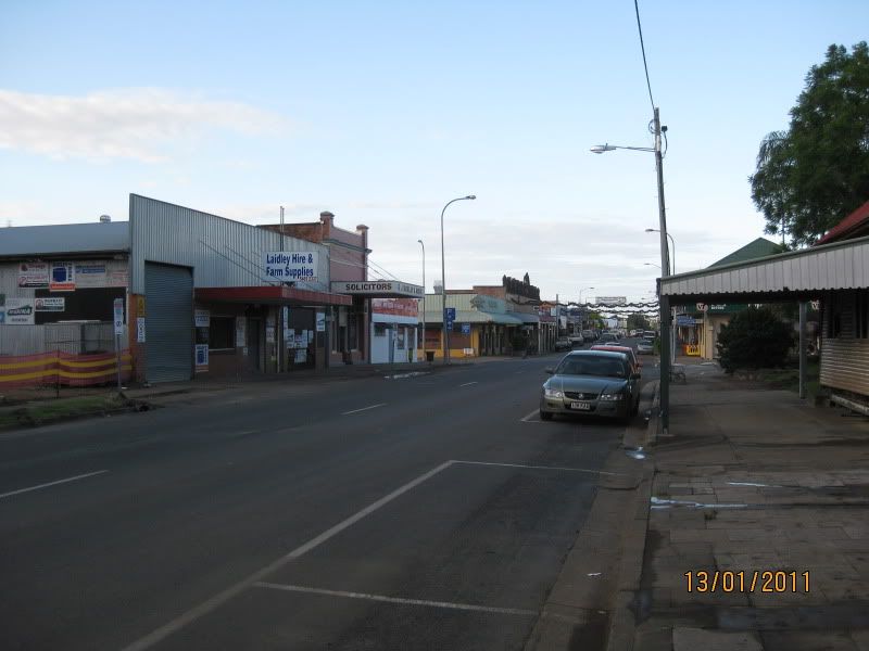
Looking down Patrick Street to where the water came up from. The water passed where I was taking this photograph and reached the railway line behind me.
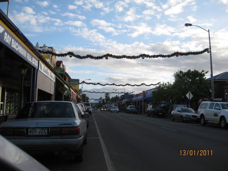
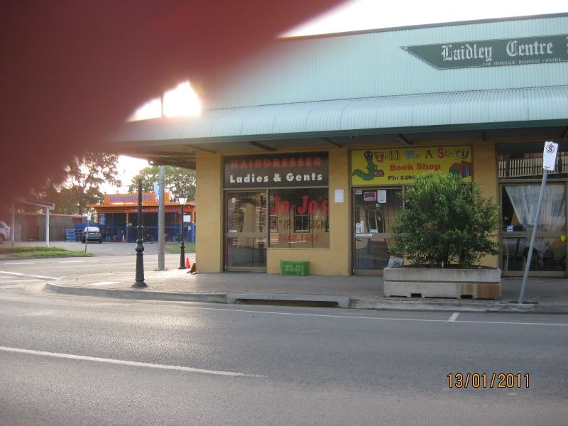
This shop is at the bottom of that stretch above, the shop past the sign you see above the car with its headlights on. There is a line just below the words Jo Jos which goes across the door, the water sat at this level for a while.. I heard again today that the water was one foot off the ceiling in this shop. This shop is opposite the Laidley Hotel which had two metres of water through it. (Hand over lens to protect from setting sun.)
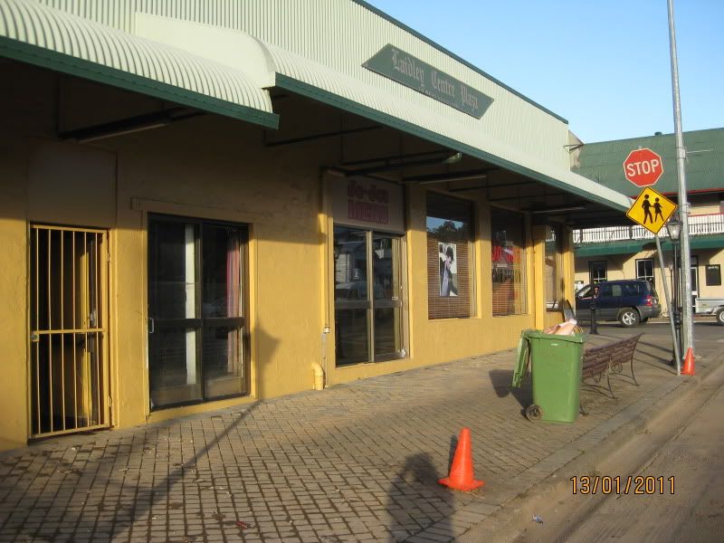
Looking at the side of Jo Jos salon. You can see a water/debris mark on the doorway which is just under five feet high.
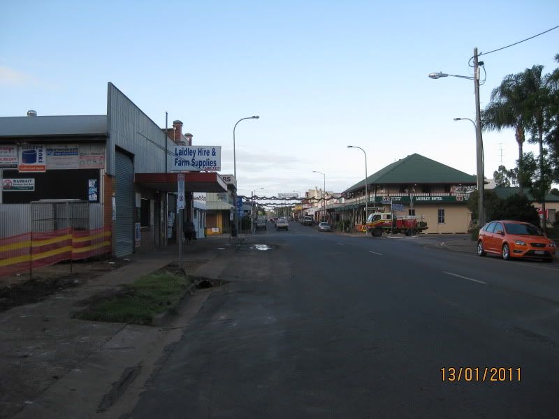
Looking back up Patrick Street, William Street is on the right. There was a photo in the Daily Telegraph of a man picking up food out of the water on Wednesday, I think this was where the photo was taken. Someone will have to compare the photos.
Same shot from the opposite side of the road, there is the hire sign, solicitor sign and the coffee cup above the awning outside Delish cafe.
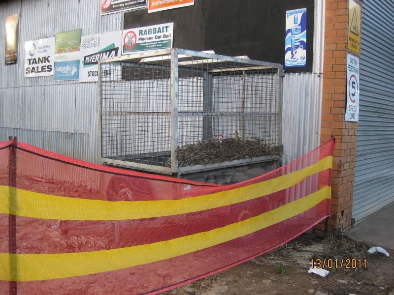
The trailer beside the produce store, note the debris in the trailer - I understand that the water was much higher than this.
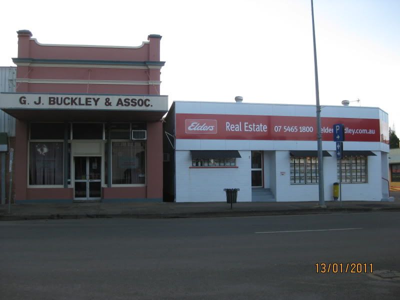
Was this a butcher shop many years ago?

This shop is at the bottom of that stretch above, the shop past the sign you see above the car with its headlights on. There is a line just below the words Jo Jos which goes across the door, the water sat at this level for a while.. I heard again today that the water was one foot off the ceiling in this shop. This shop is opposite the Laidley Hotel which had two metres of water through it. (Hand over lens to protect from setting sun.)

Looking at the side of Jo Jos salon. You can see a water/debris mark on the doorway which is just under five feet high.

Looking back up Patrick Street, William Street is on the right. There was a photo in the Daily Telegraph of a man picking up food out of the water on Wednesday, I think this was where the photo was taken. Someone will have to compare the photos.

Same shot from the opposite side of the road, there is the hire sign, solicitor sign and the coffee cup above the awning outside Delish cafe.

The trailer beside the produce store, note the debris in the trailer - I understand that the water was much higher than this.

Was this a butcher shop many years ago?

Six degrees....
I have just learnt that a work friend's son lost a mate in the Grantham flood. It was the Mum, stepdad and son in the house with the son on the phone to his aunty.
Wednesday, January 12, 2011
Aftermath - how high?
In the low part of town, near Jo Jos hair salon, the water was close to five feet deep. That's opposite the Laidley Hotel. The town is shut tonight. I guess they're all waiting for the insurance assessors before they can breathe. The flood mitigation drain overflowed before the river broke its banks so I hope they'll get the payouts they need. (Dang, my insurance will skyrocket next year!)
Here's a pic of Jo Jos taken on my phone as I forgot my camera!


Here's a pic of Jo Jos taken on my phone as I forgot my camera!


Aftermath - For Brisbane the "fun" is just beginning...
No bread, running out of teabags, so ventured to the Woolies on the highway to get some. Had to wait in a queue for about a half-hour for bread.
Everyone got two loaves, freshly baked. There's not much on the bakery shelves, in fact there's nothing. I gave my extra loaf to the restaurant owner who is waiting for the insurance assessor to arrive. He looked after Mum and I when we were flooded out on 27/12 so it was the least I could do.
Dang. Forgot to buy teabags.
The fresh produce is nearly all gone, no eggs and no milk. Meat is dregs, not much of anything left... see photos below. Brisbane is going to get worse before it gets better!
So... what's in the shops?
Cold meat? Not much selection.
 Hmm. Something nice to cook for tea tonight? I don't think so...

Okay. Need some frozen beans... Lucky me! The cupboard is bare, but there were three packs of beans.

Good thing I don't need any dunny paper.
 No dry cat or dog food in the big bags. No kitty litter...

It will take a while for the shelves to be replenished. The local store received a delivery of fresh produce today which was destined for Emerald, but it couldn't get through so it was delivered to Plainlands store.
Everyone got two loaves, freshly baked. There's not much on the bakery shelves, in fact there's nothing. I gave my extra loaf to the restaurant owner who is waiting for the insurance assessor to arrive. He looked after Mum and I when we were flooded out on 27/12 so it was the least I could do.
Dang. Forgot to buy teabags.
The fresh produce is nearly all gone, no eggs and no milk. Meat is dregs, not much of anything left... see photos below. Brisbane is going to get worse before it gets better!
So... what's in the shops?
Cold meat? Not much selection.
 Hmm. Something nice to cook for tea tonight? I don't think so...
Okay. Need some frozen beans... Lucky me! The cupboard is bare, but there were three packs of beans.

Good thing I don't need any dunny paper.
 No dry cat or dog food in the big bags. No kitty litter...
It will take a while for the shelves to be replenished. The local store received a delivery of fresh produce today which was destined for Emerald, but it couldn't get through so it was delivered to Plainlands store.
But wait, there's more... see next post... from the sublime to the ridiculous!
Laidley Flood Aftermath
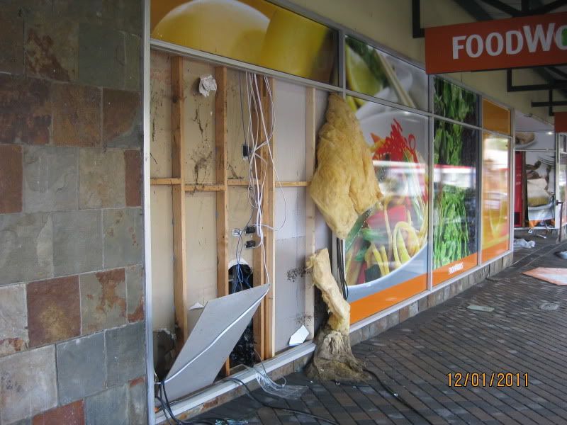
Foodworks had about two feet of water through it. It lifted up the large stuff and pushed it against the front windows and doors. All the heavy fridges and fruit stands have been piled up against the front door. The pressure was enough to pop out the two front perspex windows. A few shops had shattered windows.
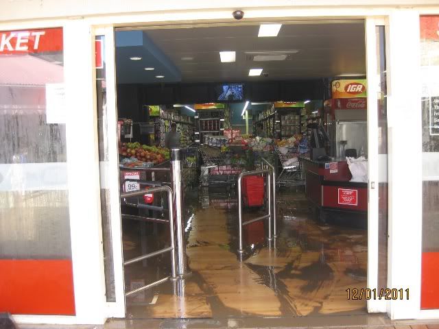
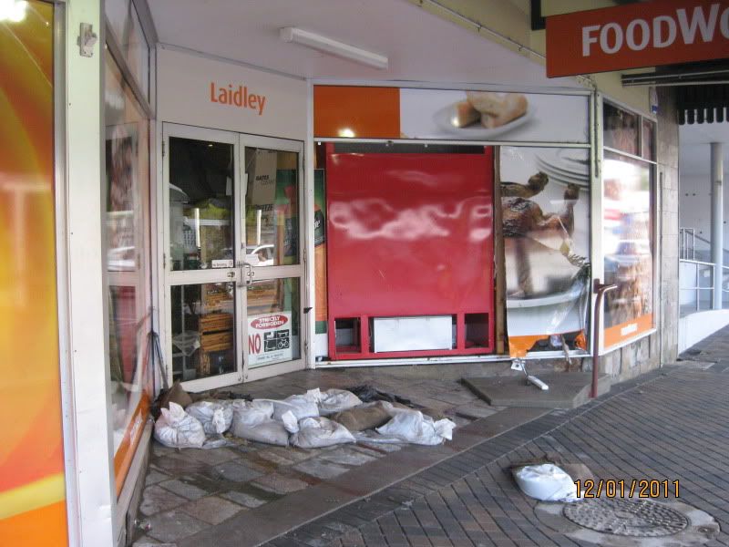 The IGA supermarket is much higher than the Foodworks shop and it had water enough to damage goods on the lower two shelves of its fittings.
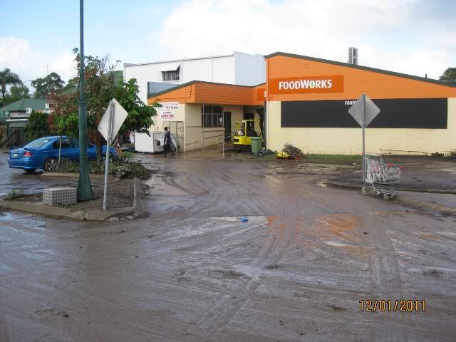
The back of the Foodworks store. You can see the mark the water has made about three inches above the window sill of the Laundromat. (Between the tree on the left and the forklift on the right.)
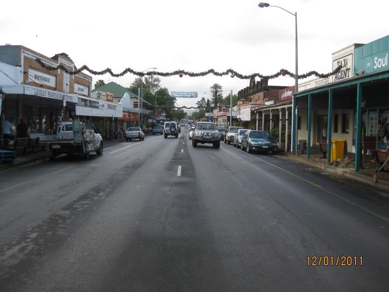
Standing on the pedestrian crossing at the top of Patrick Street, the main street, the highest place in the CBD. The water was up this high and entered several shops in the Mall.
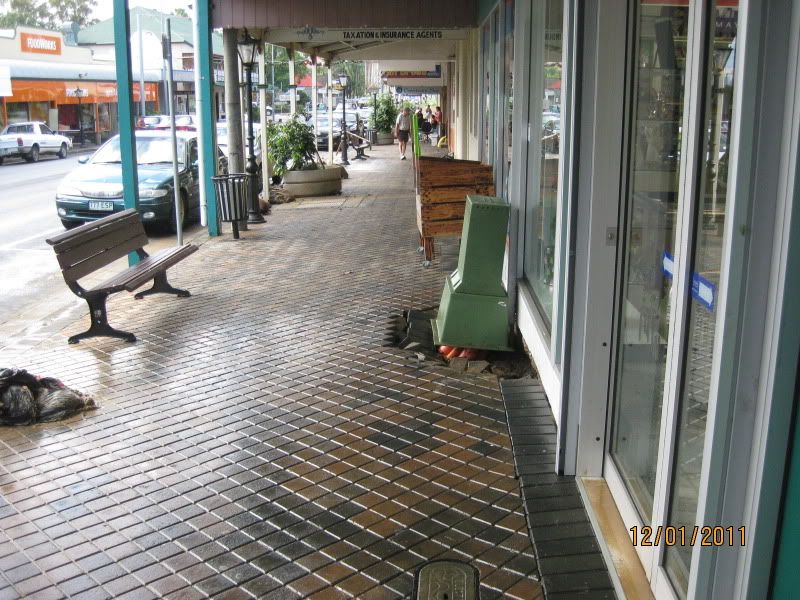
 Some of the damage in the main street. The green box is the power supply. The large wooden box is from one of the supermarkets, a fruit display box.
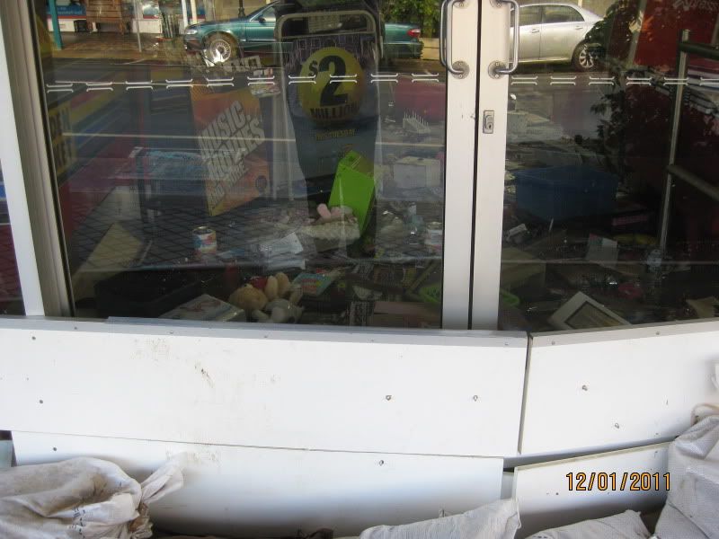
The newsagent. No papers yesterday or today... They have a lot of work to do to clean up, but are waiting for the insurance assessor to visit before they begin their clean up. Phew, stink!
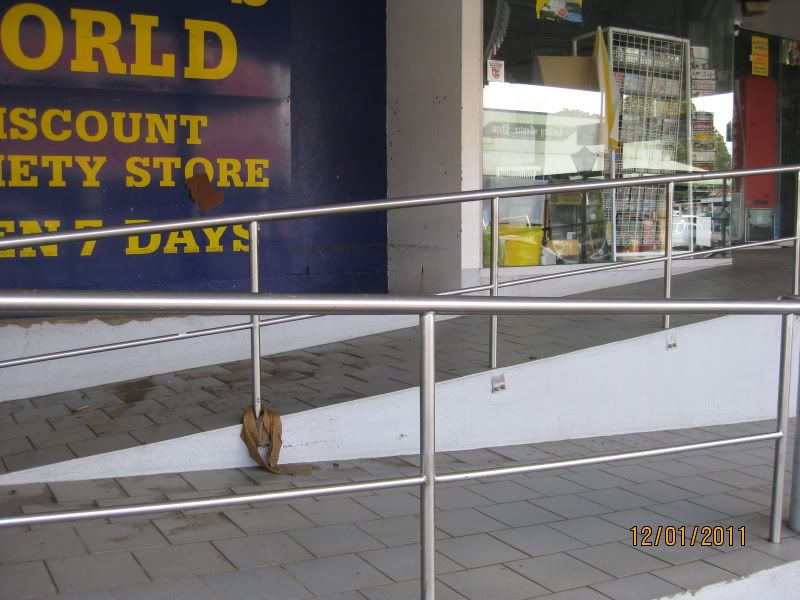
In the 1974 flood the Commonwealth Bank was inundated. They built it up so that it wouldn't happen again. The Commonwealth Bank left Laidley years ago and Wayne's World, a "junk shop" is in the premises these days. The water came up into the shop, you can see the water mark in the corner of the blue painted sign, to the right of the 's' in "Days". Looking at the cardboard above there it seems that the water was higher than the mark on the sign.
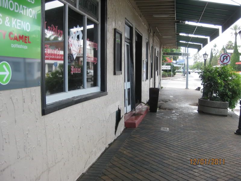
Laidley Hotel, the middle pub, where I spent New Year's Eve celebrations... quietly. They are low and would have had about 2-3ft of water across the site.
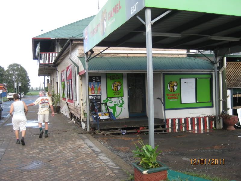
Front of the Laidley Hotel. It's even more rickety than it was before.
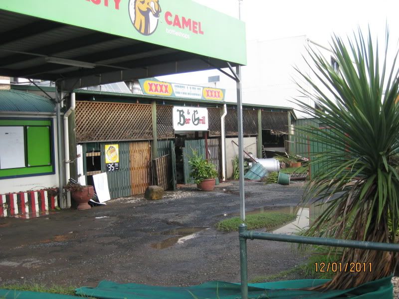
The back of the Laidley Hotel, beer garden and smoking area.
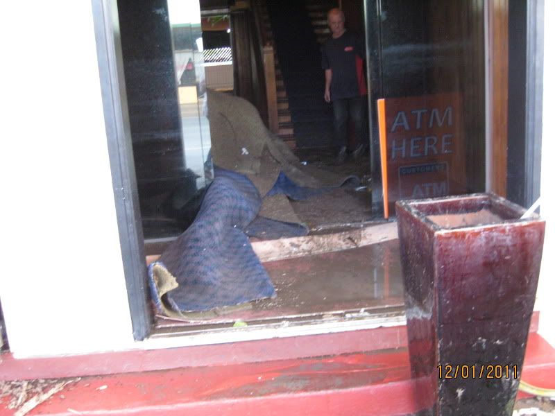
Inside the Laidley Hotel.
Looking down William Street toward Patrick Street, the building on the right with the green roof is the Laidley Hotel.
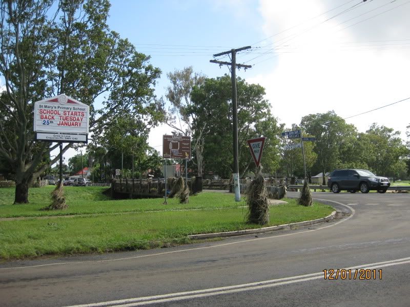
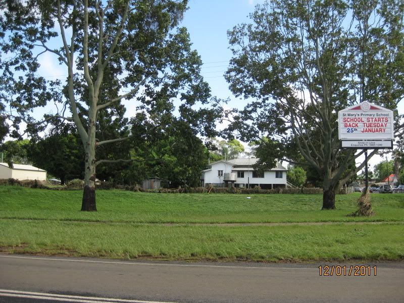
The bridge over the flood mitigation drain, diagonally opposite the town Cenotaph. Looking in the distance, the green roofed building behind the pole holding the St Mary's School sign is the Laidley Hotel.
http://i69.photobucket.com/albums/i67/Kae_album/12JAN11%20Laidley%20Flood%20aftermath/120111LaidleybridgeoverfloodmitigationdrainFerrariParkonright3.jpg
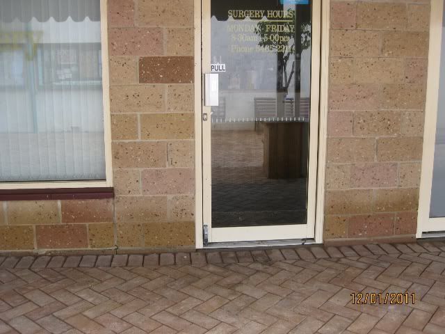
At the top of the town, at the end of the mall is the IGA store. This shop door shows a water level which is quite high for the highest part of the town!
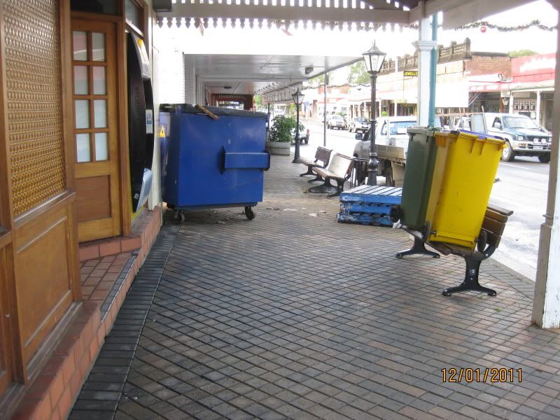
Looking down the main street toward the Foodwords store. The blue bin has washed through a laneway from the rear carpark. There were wheely bins all over the place which had washed out of the back of the shops.
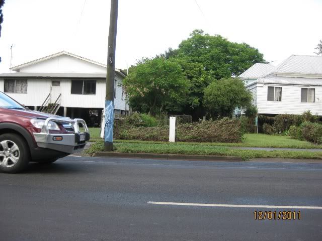
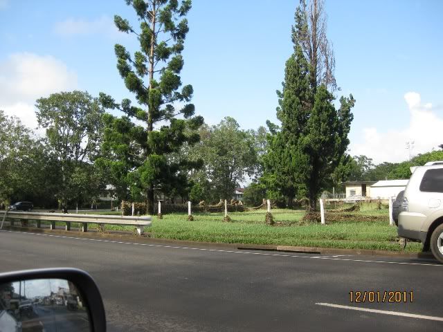
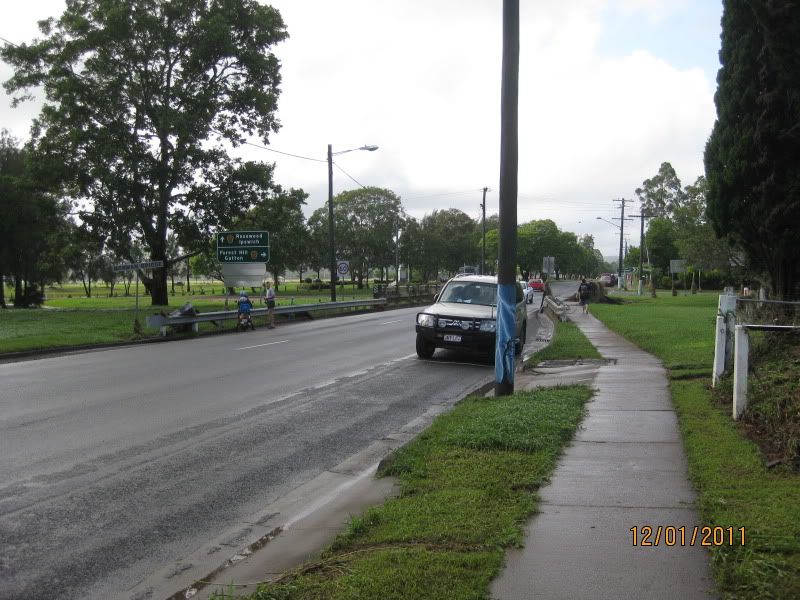
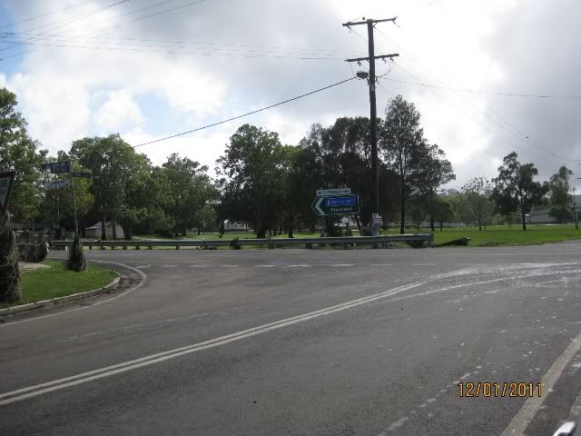
Just some pix of the bottom of town, where the water has gone over the fences. Some houses have had water through them.

 The IGA supermarket is much higher than the Foodworks shop and it had water enough to damage goods on the lower two shelves of its fittings.
The back of the Foodworks store. You can see the mark the water has made about three inches above the window sill of the Laundromat. (Between the tree on the left and the forklift on the right.)

Standing on the pedestrian crossing at the top of Patrick Street, the main street, the highest place in the CBD. The water was up this high and entered several shops in the Mall.
 Some of the damage in the main street. The green box is the power supply. The large wooden box is from one of the supermarkets, a fruit display box.
The newsagent. No papers yesterday or today... They have a lot of work to do to clean up, but are waiting for the insurance assessor to visit before they begin their clean up. Phew, stink!

In the 1974 flood the Commonwealth Bank was inundated. They built it up so that it wouldn't happen again. The Commonwealth Bank left Laidley years ago and Wayne's World, a "junk shop" is in the premises these days. The water came up into the shop, you can see the water mark in the corner of the blue painted sign, to the right of the 's' in "Days". Looking at the cardboard above there it seems that the water was higher than the mark on the sign.

Laidley Hotel, the middle pub, where I spent New Year's Eve celebrations... quietly. They are low and would have had about 2-3ft of water across the site.

Front of the Laidley Hotel. It's even more rickety than it was before.

The back of the Laidley Hotel, beer garden and smoking area.

Inside the Laidley Hotel.

Looking down William Street toward Patrick Street, the building on the right with the green roof is the Laidley Hotel.

The bridge over the flood mitigation drain, diagonally opposite the town Cenotaph. Looking in the distance, the green roofed building behind the pole holding the St Mary's School sign is the Laidley Hotel.
http://i69.photobucket.com/albums/i67/Kae_album/12JAN11%20Laidley%20Flood%20aftermath/120111LaidleybridgeoverfloodmitigationdrainFerrariParkonright3.jpg

At the top of the town, at the end of the mall is the IGA store. This shop door shows a water level which is quite high for the highest part of the town!

Looking down the main street toward the Foodwords store. The blue bin has washed through a laneway from the rear carpark. There were wheely bins all over the place which had washed out of the back of the shops.

Just some pix of the bottom of town, where the water has gone over the fences. Some houses have had water through them.


Toowoomba, Chalk Street flooding real time footage
This is the footage they've shown on the tv all the time.
Note how quickly the water rose.
The commentary is interesting for its lack of knowledge of 4WDs and locking hubs.
I've just woken up and will go have a local look. Safely!
Note how quickly the water rose.
The commentary is interesting for its lack of knowledge of 4WDs and locking hubs.
I've just woken up and will go have a local look. Safely!
Tuesday, January 11, 2011
Along the Laidley-Forest Hill Road 110111 Floods
Beyond the bridge over the creek there are local flood waters which have entered the town which is to the left of the picture. You can just see water over the road in front of the 4wd which crossed the bridge in front of me. I saw no point in going in there, and I didn't want to get trapped in this area as water was rising in front of the Bill Gunn Dam wall and crossing the road in places (see below).
There's a lot more water to come, I hope people are aware of that. It takes 8 hours for the rain which falls up the valley to reach this bridge, I'd expect more water over this bridge at about 3 or 4pm.


 Bill Gunn Dam wall, entrance to Lake Dyer camping ground.


There's a lot more water to come, I hope people are aware of that. It takes 8 hours for the rain which falls up the valley to reach this bridge, I'd expect more water over this bridge at about 3 or 4pm.


 Bill Gunn Dam wall, entrance to Lake Dyer camping ground.


Forest Hill has been evacuated, and it's an island
 In the centre of the picture above you can see the water tower and to the left of the water tower you can just see the grain silos.

 This water which is flooding is now is only the local water, it's not the Toowoomba stuff, which has passed us. We will have more flooding when the water comes down from up the valley to the south of me.
There's just been another heavy shower of rain (a storm, complete with thunder and lightning), the rain gauge is nearly full, it holds 120mm, and I just tipped out 110mm.
Latest Flood Warning
IDQ20805.
Australian Government Bureau of Meteorology
Queensland
PRIORITY
FLOOD WARNING FOR THE LOCKYER, BREMER, WARRILL AND BRISBANE RIVER BELOW WIVENHOE INCLUDING BRISBANE CITY
Issued at 9:28 AM on Tuesday the 11th of January 2011
by the Bureau of Meteorology, Brisbane.
Continuing heavy rainfall in the Lockyer Creek catchment is causing very fast
rises along Tenthill Creek.
The main flood waters in the Lockyer Creek are now arriving at Lyons Bridge,
with strong stream rises during Tuesday and levels of above 17 metres are
forecast.
Wivenhoe dam is providing significant mitigation of upper Brisbane floods. River
flows from the Bremer and Lockyer catchments combined with releases from
Wivenhoe dam will increase levels in Brisbane during Tuesday.
At the Brisbane City Gauge, minor flood levels of about 2.1 metres are expected
with the afternoon high tide on Tuesday and moderate flood levels of 2.6 metres
with the overnight high tide. Further rises to 3.5 metres (major) is expected
with the high tide on Wednesday afternoon with higher levels likely on Thursday.
LOCKYER CREEK:
Very heavy rainfall is continuing in the Lockyer Creek catchment and further
very fast rises are being observed along Tenthill Creek this morning. Renewed
rises are likely in the lower catchment during Tuesday prolonging major
flooding. The Lockyer Creek at Glenore Grove peaked at 14.60 metres at 11:30pm,
which is 0.3 metres below the 1974 flood. Renewed rises are likely at Glenore
Grove today with a return to above 14 metres.
The main flood peak from Monday is currently approaching Lyons Bridge, with
strong stream rises expected in the next few hours. A peak is expected above 17
metres at Lyons Bridge later today.
BREMER RIVER:
The Bremer River at Walloon has exceeded the moderate flood level. The Bremer
River at Rosewood peaked at 5.8 metres around midnight Monday but renewed rises
are expected as rainfall continues.
The Bremer River at Ipswich is expected to reach about 16 metres during
Wednesday. Higher levels are expected.
WARRILL CREEK
Further rises are likely today as rainfall continues.
MIDDLE AND LOWER BRISBANE:
Moderate flooding will continue to rise at Savages Crossing and at Mt Crosby
Weir.
At the Brisbane City Gauge (lower end of Edward Street and at Thornton Street),
minor flood levels of about 2.1 metres are expected with the afternoon high tide
on Tuesday and moderate flood levels of 2.6 metres with the overnight high tide.
Higher flood levels to 3.5 metres (major) are expected with the high tide on
Wednesday afternoon. Levels above 3.5 metres are expected on Thursday.
(3.5 metres at the Brisbane City gauge is about 2.5 metres higher than the
highest tide of the year at this location).
Predicted River Heights/Flows:
Ipswich: Reach at least 16 metres (major) during Wednesday; further rises.
Moggill: Reach at least 15 metres (moderate) during Wednesday; further
rises.
Jindalee: Reach at least 9 metres (moderate) late Wednesday; further
rises.
Brisbane City: Reach about 2.6 metres (moderate) with the overnight high tide
tonight. Reach 3.5 metres (major) with the high tides on Wednesday. Higher
levels are expected on Thursday with the high tides.
(3.5 metres at the Brisbane City gauge is about 2 metres higher than the highest
tide of the year at this location).
Further rises are expected at all four locations with continued rainfall.
Next Issue:
The next warning will be issued at about 3:30pm Tuesday.
Latest River Heights:
Flagstone Ck at Brown-Zirbels Rd * 3.53m rising 05:40 AM TUE 11/01/11
Sandy Creek at Sandy Creek Road # 2.9m rising 06:56 AM TUE 11/01/11
Ma Ma Ck at Harm's * 2.96m rising 05:40 AM TUE 11/01/11
Tenthill Ck at Tenthill * 5.57m rising 05:46 AM TUE 11/01/11
Laidley Ck at Mulgowie * 6.83m rising 05:00 AM TUE 11/01/11
Laidley Ck at Laidley 8.7m falling slowly 10:00 PM MON 10/01/11
Laidley Ck at Showground Weir * 8.74m rising 05:40 AM TUE 11/01/11
Laidley Ck at Warrego Hwy * 6.28m rising 05:00 AM TUE 11/01/11
Lockyer Ck at Glenore Grove # 13.48m rising 06:52 AM TUE 11/01/11
Lockyer Ck at Lyons Br # 16.09m rising 06:56 AM TUE 11/01/11
Lockyer Ck at Rifle Range Rd * 15.78m rising 05:40 AM TUE 11/01/11
Brisbane R at Lowood Pump Stn # 16.21m rising 06:55 AM TUE 11/01/11
Brisbane R at Savages Crossing # 16.17m rising 06:53 AM TUE 11/01/11
Brisbane R at Burtons Br # 12.92m rising 06:50 AM TUE 11/01/11
Brisbane R at Mt Crosby # 16.23m rising 06:36 AM TUE 11/01/11
Brisbane R at Colleges Crossing # 14.51m rising 06:57 AM TUE 11/01/11
Bremer R at Rosewood # 5.32m rising 06:41 AM TUE 11/01/11
Warrill Ck at Amberley DNR * 6.78m rising 05:20 AM TUE 11/01/11
Bremer R at Ipswich # 9.25m rising 06:50 AM TUE 11/01/11
Brisbane R at Moggill # 7.62m rising 06:45 AM TUE 11/01/11
Brisbane R at Jindalee Br # 4.75m rising 06:26 AM TUE 11/01/11
Brisbane R at City Gauge # 0.95m falling 06:30 AM TUE 11/01/11
*automatic station
Warnings and River Height Bulletins are available at
http://www.bom.gov.au/qld/flood/ . Flood Warnings are also available on
telephone 1300 659 219 at a low call cost of 27.5 cents, more from mobile,
public and satellite phones
Local flooding
Woken by a fierce thunderstorm thismorning, couldn't sleep last night.
Emptied the rain gauge yesterday afternoon before dark and there was 50mm fell yesterday at home. Thismorning I checked the rain gauge, it's at78mm 89mm which is what has fallen since dark yesterday.
I had a meeting today, but it's been cancelled. The Warrego Highway is closed at Blacksoil (Ipswich) to all traffic.
No wonder I couldn't sleep last night.


There's nothing I can do to help anyone as I can't get anywhere near town.
Update:
Emptied the rain gauge yesterday afternoon before dark and there was 50mm fell yesterday at home. Thismorning I checked the rain gauge, it's at
I had a meeting today, but it's been cancelled. The Warrego Highway is closed at Blacksoil (Ipswich) to all traffic.
No wonder I couldn't sleep last night.


There's nothing I can do to help anyone as I can't get anywhere near town.
Update:
IDQ20805
Australian Government Bureau of Meteorology
Queensland
PRIORITY
FLOOD WARNING FOR THE LOCKYER, BREMER, WARRILL AND BRISBANE RIVER BELOW WIVENHOE INCLUDING BRISBANE CITY
Issued at 4:06 AM on Tuesday the 11th of January 2011
by the Bureau of Meteorology, Brisbane.
The main flood waters in the Lockyer Creek are now arriving at Lyons Bridge,
with strong stream rises expected during Tuesday.
Wivenhoe dam is providing significant mitigation of upper Brisbane floods. River
flows from the Bremer and Lockyer catchments combined with releases from
Wivenhoe dam are expected to increase levels in Brisbane during Tuesday.
At the Brisbane City Gauge, minor flood levels of about 2.1 metres are expected
with the afternoon high tide on Tuesday and levels of about 3 metres are
expected with the high tides on Wednesday causing moderate flooding.
(3 metres at the Brisbane City gauge is about 1.5 metres higher than the highest
tide of the year at this location).
LOCKYER CREEK:
Extremely heavy rainfall during Monday led to extreme rises in the Lockyer Creek
catchment and Laidley Creek at Mulgowie. Record flood levels of 18.92 metres
were recorded at Gatton Monday evening before the station failed. This level was
well above the previous record peak of 16.33 metres from the February 1893
flood.
The main flood waters are currently arriving at Lyons Bridge, with strong stream
rises expected in the next few hours. The Lockyer Creek at Glenore Grove peaked
at 14.60 metres at 11:30pm, which is 0.3 metres below the 1974 flood.
Renewed stream rises have commenced in Lockyer Creek at Lyons Bridge with a peak
between 16 and 16.5 metres expected Tuesday morning. This is likely to be
similar in level to the 1996 flood.
BREMER RIVER:
The Bremer River at Walloon has exceeded the moderate flood level. The Bremer
River at Rosewood peaked at 5.8 metres around midnight monday.
The Bremer River at Ipswich is expected to reach about 12.7 metres on Tuesday
afternoon. Higher levels are possible.
WARRILL CREEK
Warrill Creek at Amberley peaked at 5.98 metres around 9pm Monday.
MIDDLE AND LOWER BRISBANE:
Moderate flooding is developing at Savages Crossing and at Mt Crosby Weir.
At the Brisbane City Gauge (lower end of Edward Street and at Thornton Street),
minor flood levels of about 2.1 metres are expected with the afternoon high tide
on Tuesday and levels of about 3 metres are expected with the high tides on
Wednesday causing moderate flooding.
(3 metres at the Brisbane City gauge is about 1.5 metres higher than the highest
tide of the year at this location).
Predicted River Heights/Flows:
Ipswich: Reach about 12.7 metres (major) during Tuesday afternoon.
Moggill: Reach about 12 metres (minor) during Tuesday afternoon.
Jindalee: Reach about 7 metres (minor) overnight Tuesday.
Brisbane: Reach about 2.1 metres (minor) with the afternoon high tide on
Tuesday. Reach about 3 metres (moderate) with the high tides on Wednesday.
(3 metres at the Brisbane City gauge is about 1.5 metres higher than the highest
tide of the year at this location).
Further rises are possible at all four locations depending on further rain.
Next Issue:
The next warning will be issued at about 8am Tuesday.
Latest River Heights:
Lockyer Ck at Helidon # 12.68m steady 03:02 PM MON 10/01/11
Flagstone Ck at Brown-Zirbels Rd * 3.49m falling 02:10 AM TUE 11/01/11
Sandy Creek at Sandy Creek Road # 2.15m falling 03:19 AM TUE 11/01/11
Ma Ma Ck at Harm's * 3.26m rising 02:30 AM TUE 11/01/11
Tenthill Ck at Tenthill * 5.57m rising 02:40 AM TUE 11/01/11
Lockyer Ck at Gatton # 18.92m rising 06:30 PM MON 10/01/11
Laidley Ck at Mulgowie * 6.39m rising 02:20 AM TUE 11/01/11
Laidley Ck at Laidley 8.7m falling slowly 10:00 PM MON 10/01/11
Laidley Ck at Showground Weir # 7.84m rising 03:25 AM TUE 11/01/11
Laidley Ck at Warrego Hwy * 6.41m rising 02:00 AM TUE 11/01/11
Lockyer Ck at Glenore Grove # 13.8m falling 03:24 AM TUE 11/01/11
Lockyer Ck at Lyons Br # 15.55m rising 03:23 AM TUE 11/01/11
Lockyer Ck at Rifle Range Rd * 15.39m rising 02:40 AM TUE 11/01/11
Lockyer Ck at O'Reilly's Weir # 18m falling 03:28 AM TUE 11/01/11
Brisbane R at Lowood Pump Stn # 15.93m falling 03:31 AM TUE 11/01/11
Brisbane R at Savages Crossing # 15.89m rising 03:29 AM TUE 11/01/11
Brisbane R at Burtons Br # 12.22m rising 03:29 AM TUE 11/01/11
Brisbane R at Kholo Br # 7.99m rising 03:29 AM TUE 11/01/11
Brisbane R at Mt Crosby # 15.82m steady 03:30 AM TUE 11/01/11
Brisbane R at Mt Crosby # 14.08m falling 04:39 PM MON 10/01/11
Brisbane R at Colleges Crossing # 13.91m rising 03:32 AM TUE 11/01/11
Bremer R at Rosewood# 5.56m falling 03:11 AM TUE 11/01/11
Bremer R at Five Mile Br Walloon # 6.4m rising 03:15 AM TUE 11/01/11
Warrill Ck at Greens Rd Amberley # 5.84m falling 03:29 AM TUE 11/01/11
Bremer R at One Mile Br # 13.75m rising 03:31 AM TUE 11/01/11
Bremer R at Hancocks Br Brassall # 11.33m rising 03:22 AM TUE 11/01/11
Bremer R at Ipswich # 8.55m rising 03:31 AM TUE 11/01/11
Brisbane R at Moggill # 7.07m rising 03:29 AM TUE 11/01/11
Brisbane R at Jindalee Br # 4.5m rising 03:29 AM TUE 11/01/11
Brisbane R at City Gauge # 1.4m falling 03:15 AM TUE 11/01/11
*automatic station
Warnings and River Height Bulletins are available at
http://www.bom.gov.au/qld/flood/ . Flood Warnings are also available on
telephone 1300 659 219 at a low call cost of 27.5 cents, more from mobile,
public and satellite phones.
Subscribe to:
Posts (Atom)